Knowing the exact location of boundaries is the basic part of owning a property. Arguments are bound to be on the way when if the boundaries are not clear. Be it private property, commercial property, land for mining or land for drilling – boundaries have to be clear. Landowners will have to commission a boundary survey in case of conflicting views regarding boundary lines.
What Does Boundary Survey Mean?
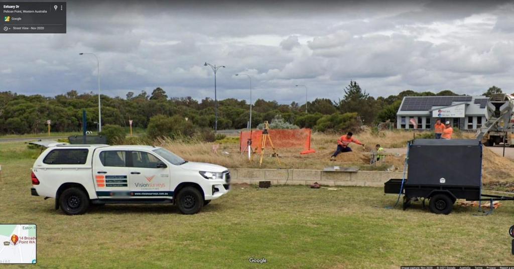
Boundary surveys are done for the properties in Perth for defining the property boundaries. The surveyors largely focus on significantly defining the corners of the land parcel. Generally, the property owners commission the boundary surveys before they buy, divide, improve or construct on land. After completing the boundary surveys, the boundary surveyors draw the lines and create a map. So, professional boundary surveying is important since qualified surveyors know how to take the exact measurements. The professionally drawn survey contains –
a. Lot Dimensions
The lot dimensions are from the deed, subdivision plats and survey drawings showing the exact property lines.
b. Improvement Area Markings
Through boundary surveys, the land areas to be improved can be detected and subsequently planned, like houses, garages, sheds, pools and related other permanent changes.
c. Fencing
Fences are meant to inform where the property stands. However, rarely are they built directly on the property lines. Even if fences are included in the drawings, still do not consider them as the property outlines.
d. Easements
The surveyor includes the easements on the drawing provided they are having a title commitment copy.
What Are the Boundary Survey Processes?
The boundary surveyors follow a meticulous process to complete a boundary survey. They are serious about defining the boundaries since it is an important legal task. These are the general steps they undertake to complete the boundary surveys :
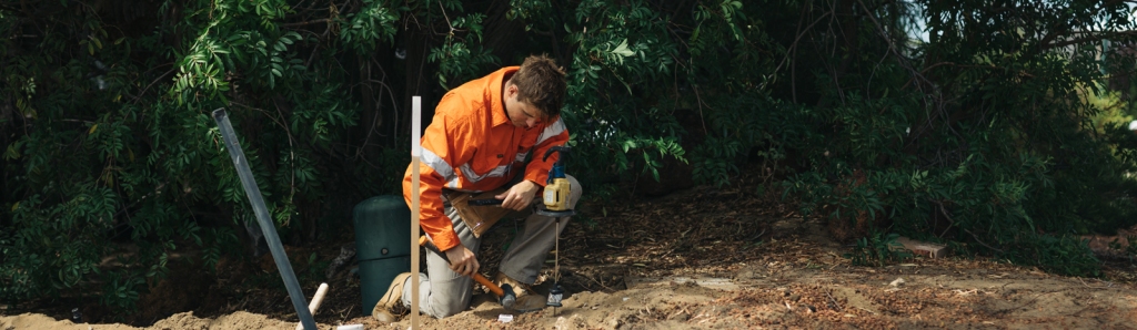
1. They locate and verify each corner of the property; or reestablish and reset if the corner location is unclear.
2. At each corner, the surveyors put a marker, like a rebar or iron pipe about 2 feet tall so they can be easily seen across the property.
3. After the surveyors have placed the marker, they spray paint the corners with pink paint for ensuring clear visibility.
4. For locating the property corners, the surveyors even install wooden stakes or flags near the property corners with labels.
5. The owner who has commissioned the survey is free to make a choice for improvements like homes, sheds, buildings, fences, pools or other permanent structures to be displayed on the boundary drawings.
6. The surveyor notes all the potential encroachments.
The boundary drawings are legally binding documents. They make sure to comply with the laid down State rules and regulations to define the property lines and detail the land parcels.
What Are The Components of A Boundary Survey?
The actual boundary survey is complete with its necessary components and specific steps.
1 – A registry research is the very first vital component of a boundary survey. A boundary survey is successful with the information about deeds which helps the surveyors to conduct extensive research in the country registry of deeds. Even private and public research is necessary for effective boundary surveys to fill in good deed information that the registry of deeds has missed out on. Private and public research is obtained from varied sources like municipal offices, historical societies, other land surveyors, state agencies and information from abutting land owners and the country commissioner’s office.
2 – Once the research is over, the surveyor starts preparing the deed sketch. First, the surveyor creates a worksheet identifying record calls along each boundary line. There are many boundary lines having several different distances or calls over an extended time. It is a reason why reason is so important. If the research works out with the original deed, then the original grantor’s intentions for the property can be shown.
3 – The Field reconnaissance is the largest boundary survey component. When they are at fieldwork, the boundary surveyors explore the property, mark all the corners, and collect all necessary information to complete the drawing.
4 – Being done with the field reconnaissance, the surveyor enters and analyzes the data. The data is reviewed, and validated and its mathematical accuracy is verified. When they do the data entry and analysis component of the survey process, the boundary surveyors determine the acreage, encroachments, easements, corner locations, rights of way and other various aspects.
5 – The next stage after completing the data entry and analysis is final plan preparation. In the final plan, the surveyor includes the results of all final findings and recommendations. Generally, the final plans are done to a standard for other land surveyors to do findings verifications. The plan is an insured legal document prepared in compliance with State Board of Licensure requirements.
6 – Visiting back to the property site is the final component. The surveyor clearly marks the property corners and lines for the property owners. Further, the markings are signs that the land has been surveyed officially.
For every ownership due diligence in Perth, a boundary survey is an important aspect. Boundary surveys are needed when you have planned subdividing, extending, and improving your property. Boundary surveys have the purpose to show the property’s legal limits, generally by defining the plot’s corners. This is all about avoiding expenses and the stress of potential legal disputes with neighbours and the Council.
Often title and lending companies seek professional boundary survey proof to minimise the lending risk. So, the task should be done by a registered land surveyor who can follow the right process for surveying the property boundaries.


